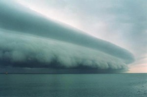
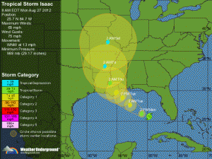
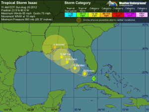
No, I don’t know what causes this- can’t be good though. Pray for those poor folks in the path of Sandy.
Around and around
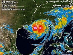
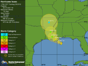
Izzy just sits there and spins, and southern Louisiana gets more and more water pumped on it. One levee has already failedbeen overtopped, but the dry air mass is still supposed to mitigate the very worst case scenarios. It still sucks to be there now I’m sure.
As I said before, praying is about all anyone outside the area can do at the moment- just be ready to jump in and help however you can once the damn thing moves on. That, however, is taking far too long.
Oh boy
It just keeps getting better- per Brendan Loy (careful loading that link, it has a ton of animated gifs that will slow your PC to a crawl)-
With the eye remaining over water, Isaac still has a chance to maintain its strength, or even perhaps strengthen a little, for quite some time. Even once it moves over the swampy bayous, that may remain true. According to the11pm NHC discussion, little change in strength in expected over the next 12 hours. (Note: the barometric pressure has actually dropped to 968 mb.)
So, at this speed, all of southeastern Louisiana is going to take an extended battering, both from the winds and, more importantly, from the rain — possibly as much as 20 inches or more — and storm surge. (The surge is still rising at Shell Beach, LA, for instance.)
In other words, not good at all. LSU and Saints fans can look forward to at best a squishy weekend. At worst, well-
Wet and getting wetter
We’re pretty much OK here, but the prospects over Louisiana aren’t quite as good. Via Jeff Master’s blog at Weather Underground–
A dangerous storm surge event underway
Isaac is bringing large and dangerous storm surge to the coast from Central Louisiana to the Panhandle of Florida. At 10 pm EDT, here were some of the storm surge values being recorded at NOAA tide gauges:6.2′ Waveland, MS
9.9′ Shell Beach, LA
3.0′ Pensacola, FL
4.4′ Pascagoula, MS
3.4′ Mobile, ALThe 9.9′ storm surge at Shell Beach, which is in Lake Borgne 20 miles southeast of New Orleans, exceeds the 9.5′ surge recorded there during Category 2 Hurricane Gustav of 2008. Research scientists running a Doppler on Wheels radar located on top of the 16′ levees in Plaquemines Parish near Port Sulphur, LA, reported at 8:30 pm EDT that a storm surge of 14′ moved up the Mississippi River, and was just 2′ below the levees. Waves on top of the surge were cresting over the west side of the levee. Needless to say, they were very nervous. Over the past hour, the surge has retreated some, and waves were no longer lapping over the top of the levee. This is probably due to the fact that we’re headed towards low tide. A storm surge of 9.5′ has moved up the Mississippi River to the Carrrollton gauge in New Orleans. This is not a concern for the levees in New Orleans, since the storm surge has now brought the river up to 2.5′ above its normal water level, which was 7′ low due to the 2012 U.S. drought. The highest rise of the water above ground level will occur Wednesday morning over much of Southeast Louisiana, Mississippi, Alabama, and the western Florida Panhandle, when the tide comes back in. It is clear now that this storm surge event will be as dangerous as that of Category 2 Hurricane Gustav of 2008. One piece of good news: NWS New Orleans successfully launched their 00Z balloon. However, their discussion noted the atmosphere is “saturated or nearly saturated” all the way up to 470mb, or 20,000 feet. Precipitable water was 2.76 inches, which will be ripe for extremely heavy rainfall.
Izzy’s liable to sit and pump water into southern Louisiana for a good long while- prayers for the folks there might be in order.
Lazy, lazy storm
Here Comes The Rain
I keep hearing this song in my head
[jwplayer mediaid=”273″]
Battle of New Orleans?
Wow, it looks like it’s gonna suck to be in Nawlins–
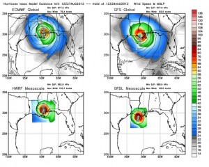
This particular forecast is, as Maue says, a nightmare. There’s just been much more uncertainty than with most hurricanes, and that remains true, even at this late date.
As an aside, it looks like Isaac may be upgraded to a hurricane — or else very, very nearly one — at 5:00 PM Eastern. Stay tuned.
I have friends in Metairie- I surely hope it doesn’t play out like it’s looking now. For Mobile though, looks like just a good drenching.
If some of those models play out the midwestern U.S. drought may just be about to end.
from Naples, Florida
Any minute now
This is like waiting on your date on prom night (for us guys)-
Mebbe Izzy will, mebbe Izzy won’t. Later today might tell the tale, but there’s just as good a chance he will get to the middle of the Gulf this afternoon and just sit there thinking. Looks good for us right now but kind of sucky for Nawlins. Waiting, waiting…
This can’t be good
Brendan Loy has a disturbing post up-
In a bizarrely low-key press conference that seemed more focused on calming residents’ “anxiety” and vaguely telling them to “be prepared” (and then making of a series of mundane announcements about municipal matters like trash collection and parking restrictions) than on advising them to take specific, concrete steps commensurate to the risk of a possibly major hurricane potentially making a direct hit on America’s most hurricane-vulnerable city starting in about 48 hours, New Orleans Mayor Mitch Landrieu did his best Ray Nagin impression Sunday, announcing a no-evacuation, “shelter in place” plan that suggests a stunning level of confidence that a worst-case scenario won’t happen, at a time when it remains, meteorologically speaking, very much in play.
The possibility that residents would be “sheltering in place” in a “place” the could, in the worst-case scenario, be swallowed up by the Gulf of Mexico, was not mentioned.
Maybe it would be better if the dang thing did hit Mississippi- at least poor Nawlins wouldn’t drown so much. So Much being the operative phrase- being to the left of a blow is much worse than on the right.
Enough hyperventilating please
insert ‘eye roll’ here
We’re All Gonna Die!
…not really. But it should get a little exciting around here for a while.
I’m going to blog it as much as I can- I’m sure at one point I’ll find out how well I can blog from my phone. Woohoo!
Actually a Cat 2 is not that big a deal, a messy PITA but not much more than that- and from my experience during Katrina the folks in Alabama and Mississippi are remarkably able to jump in and clean up afterwards quite quickly. So no worries here.
Sorry for the lax posting the last couple of days- my PC decided to make my life more interesting and had a hard-drive take a dump. Fixed now, so back in business.
So bring yo’ bad self on Izzy!


